You can already find out a lot about your commute by using Google Maps, and you soon may be able to find out how hard it will be to find a parking place once you arrive at your destination. Android Police is reporting a new feature present for some users in the Google Maps v9.44 beta that details parking information near your destination when you set driving directions.
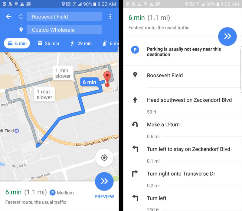
When you first set a destination, a parking availability indicator appears next to your estimated driving time in the form of a "P" symbol. There appear to be three levels of parking availability: "easy," "medium," and "limited" for areas where parking is typically hard to come by. During your drive, you can expand the turn-by-turn directions to see a more detailed explanation of your destination's parking situation. While the descriptions are not real-time indicators of the parking situation you're driving into, they do tell you how easy it "usually" is to find a parking spot near your destination.
According to Android Police's report, parking information currently shows up for public places like shopping centers and airports. There's no telling how many users have access to the parking information feature yet, or where it's being rolled out to first. We downloaded the v9.44 beta in the New York City/Long Island area to a Samsung Galaxy S7, and parking information did show up. Give it some more time if you're using the v9.44 beta and don't see parking information yet.
reader comments
60